In this project, we helped a housing developer unlock the potential of a complex site in the beautiful neighbourhood of Nordstrand, in Oslo. Bringing together our skills in site analysis and visualisation, we designed and presented alternative development strategies for the site, helping the developer and the site owner to build architecture that is both inspiring and financially viable.

A visualisation of the site with sun access at different season, as part of our site anany
A view of the site before development, with its mature trees and steep north-facing rocky slope at the back
Surrounding by elegant villas with fantastic views to Oslo Fjord, the undeveloped site had a complex topography, with a north-facing rocky slope dropping 11 meter drop across the site, overgrown with several large mature trees.
This unusual configuration made the site unsuitable for standard off-the-shelf housing solutions. So the developer asked us to assess the viability of a development and to bring in some creative thinking to showcase the potential of the site to the site owner.
Analysing the site
Using available topographic information and photos, we started by creating a 3D model of the site landscape and its surrounding, which would serve as the basis for our analysis and presentation.
The various layers of planning regulations for the site were then analysed and compiled into a clear set of constraints applying to the project. The surrounding architectural context was also carefully taken into consideration, so that the development would not only integrated with the landscape, but also related meaningfully with the existing architectural language and scale of the residential area.
Our visual representation of the constraints on the complex site considerably simplified the decision-making process for the developer
Identifying viable development options and their planning consequences
Presenting these constraints visually, together with topographic and climatic data, we summarised a set of alternative scenarios for the development, each with the associated areas, possible building forms, parking and access requirements and consequences on the potential complexity of the planning process.
With all information clearly summarised, the developer could easily review the options — weighing costs versus complexity of the required planning process — to select an optimal development scale matching his financial and marketing approach.
Thinking with the landscape
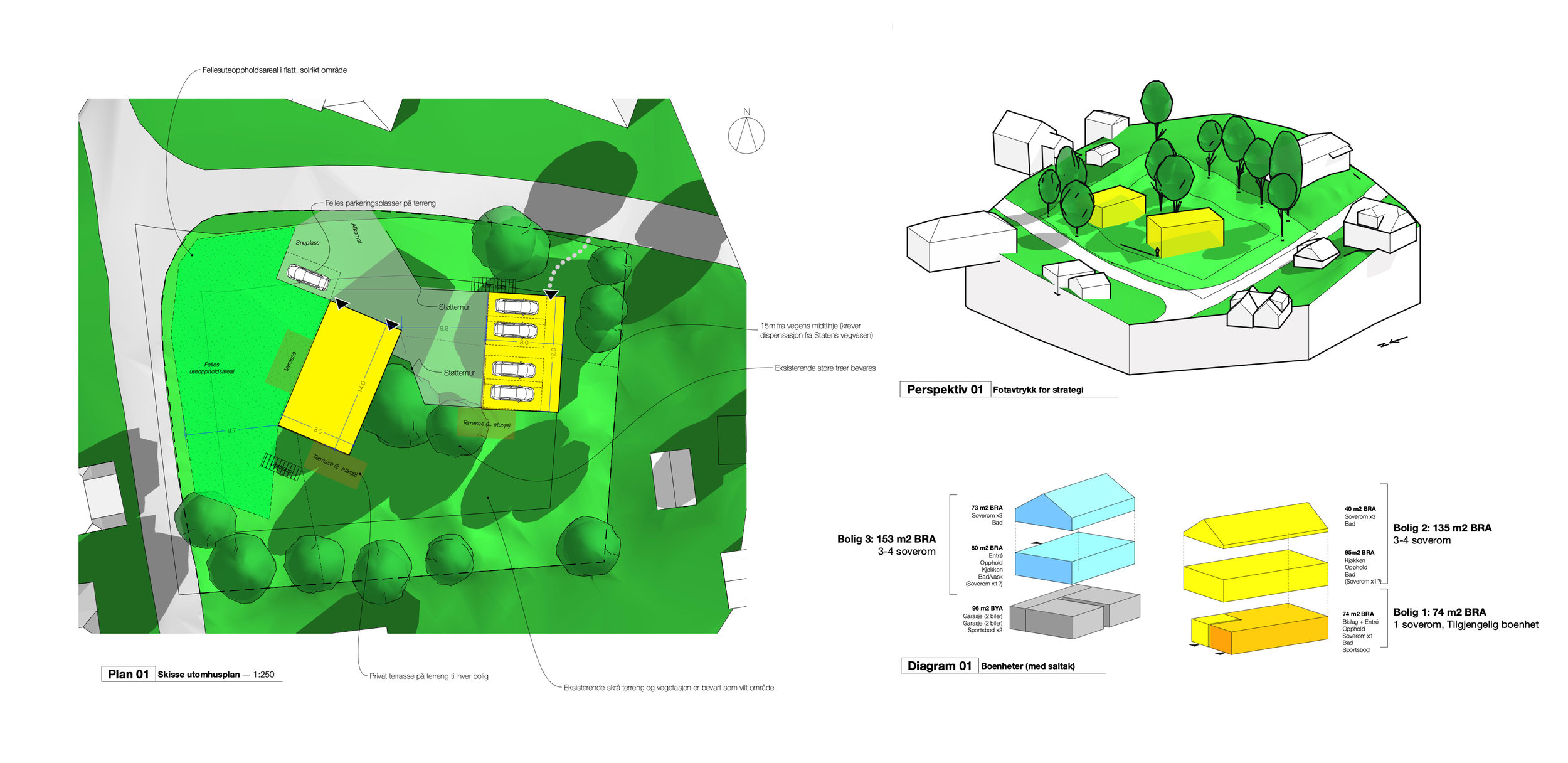
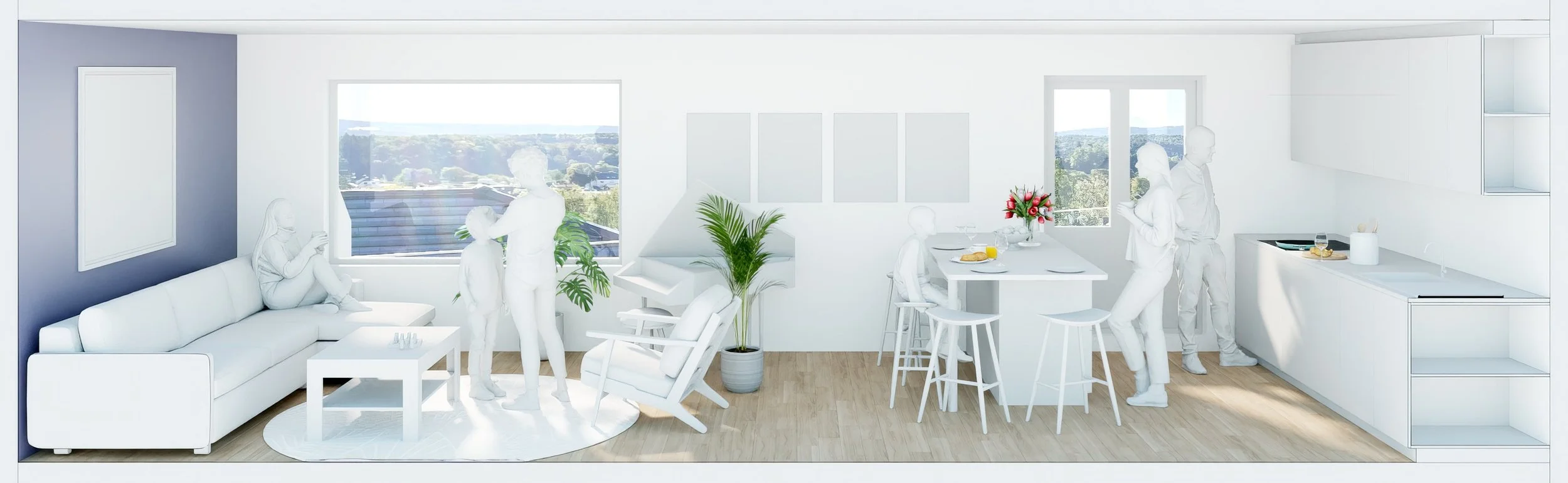
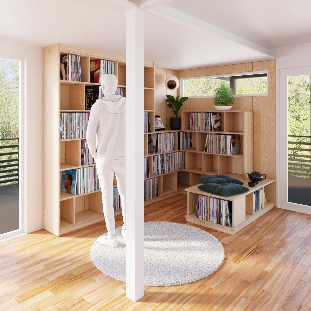
With the project scale now clearly defined (in our case, three single family units), we proceeded with structuring the site and developed alternative architectural strategies based on this scenario.
Our focus was on preserving the natural feel of the site, making the most of the existing topography and vegetation to create attractive outdoor spaces with extensive access to the sun for a large part of the year, despite the awkward orientation of the site.
The dwellings were articulated around the different levels of the landscape to minimise groundworks on the site, preserve the existing trees and promote accessibility.
Their volumes were laid out to reduce self-shading of the garden areas, balancing open communal outdoor areas with more private garden spaces linked to each dwelling, framing view from the living spaces and preserving a feeling of privacy from neighbours.
Taking an informed decision
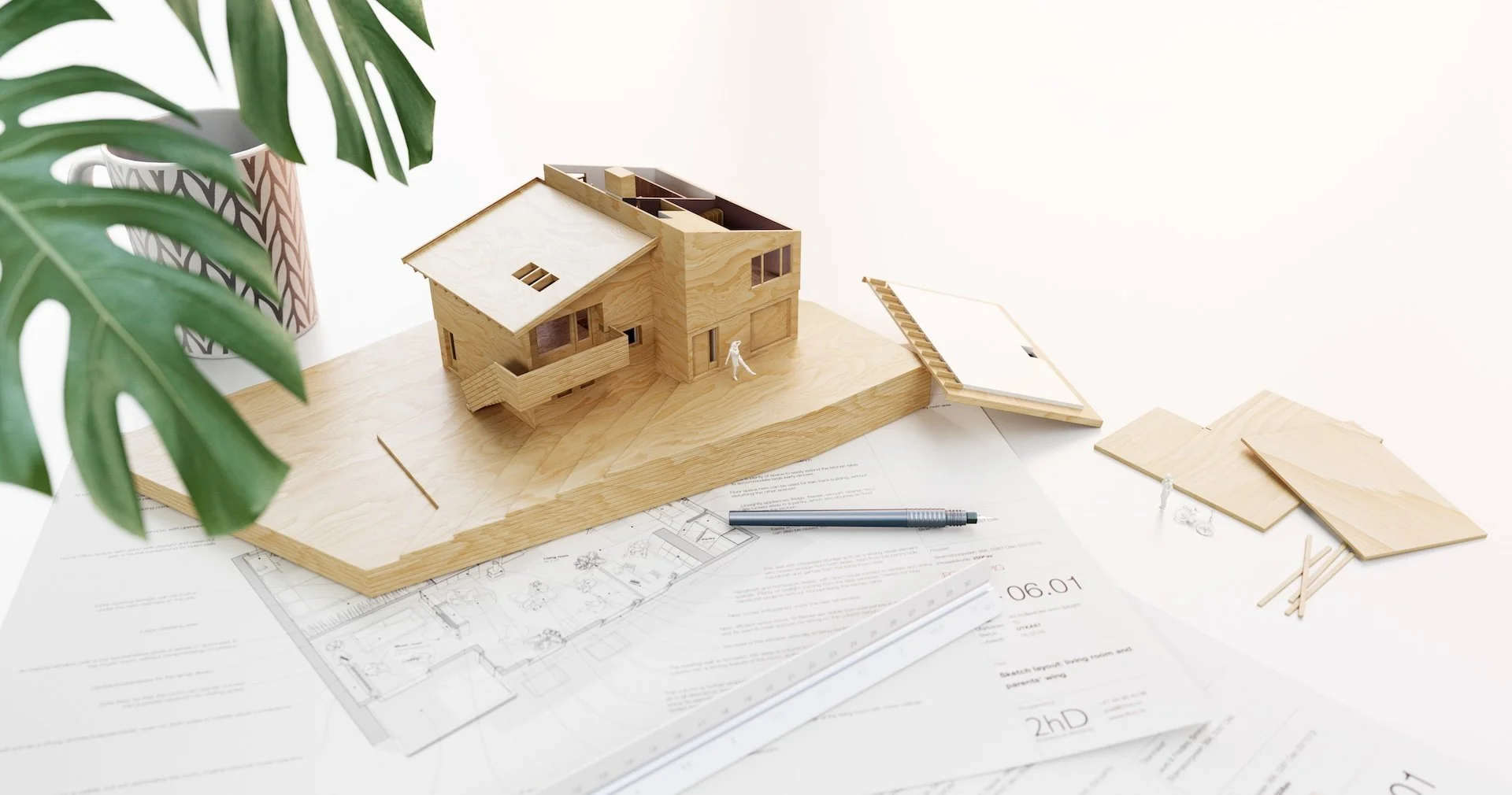
The result was five alternative architectural strategies that could be presented by the developer to the site owner.
We organised our presentation around clear diagrams that visually summarised each strategy, with site plans, massing perspectives and outline dwelling organisations. so that the site owner — who had no previous experience in development — could appreciate the potential of the site and take inform decisions about its future.